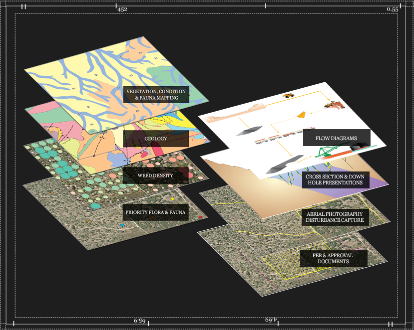
Using 2D data supplied from either your company, or utilizing our large in house Atlas of GIS data, CAD Resources can produce a range of figures for presentations and reports
- Vegetation Mapping
- Vegetation Condition Mapping
- Flora & Fauna Site Mapping
- Weed Density Mapping
- Soils Mapping
- Wetlands Mapping
- Project Location Figures
- Geological Mapping
- Cross Section Representations
- Down Hole Presentations
- Aerial Photography Disturbance Capture
- Land Use Figures
- Clearing Permit Figures
- PER Figure sets
- Mining Proposals
- POW Figures
- Flow Chart Diagrams
- ASX Releases
- Tenement Holder Figures
- Route Alignment Descriptions
- Wind Rose Figures
- Infrastructure Conflicts
- Plotting
- PowerPoint Presentations
- Graphics to Publishers
All this data can then be translated into your preferred system and detailed calculations completed as required.